Modernist Transit Diagram (Vignelli/Beck Abstraction)
The map abstracted to pure system logic: geographic accuracy surrendered for topological clarity, color-coded lines representing routes, stations shown as symbols, the city reduced to a network diagram.
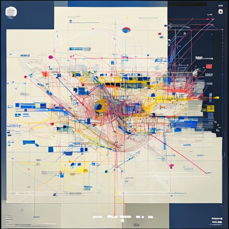
The prompt
Re-render this location as a modernist transit system diagram in the style of Harry Beck and Massimo Vignelli, the abstract cartographic system that prioritizes network topology over geographic accuracy. Rendered on clean white or cream stock with bold colored lines and geometric symbol notation. Base layer: minimal background, no conventional geographic detail, no terrain or topography, no visible street grid (geographic accuracy is abandoned for legibility). Route lines: bold colored lines in primary colors (red, blue, yellow, green, black, orange, purple, brown) or a coordinated modern palette, each line representing a major transit route, rendered as perfectly straight segments or simplified curves, angles fixed at 45-degree increments or geometric simplification. Station symbols: small filled circles or simplified geometric symbols (squares, triangles, diamonds) positioned at regular intervals along routes, rendered in white or contrasting color, interconnected only by the route lines. Interchange stations: larger or doubled symbols where multiple routes meet, indicated by symbol clustering or reinforced notation. Line labels and identifiers: route names or numbers rendered as colored bands or simplified cartouche elements (no legible text, render as text-free annotation blocks). Geographic reference points: only major terminus stations or strategic landmarks shown, rendered as expanded symbols or distinctive marker shapes. Grid structure: underlying geometric organization visible in the line angles and spacing, enforcing visual harmony and systematic clarity. Color-coding legend: shown as simple color-block reference (no legible text, render as symbolic color key). Paper surface: crisp modern print stock, clean white or very light tone with controlled aging (no foxing, minimal wear). Preserve the subject, pose, and composition of the source image exactly, change only the medium and rendering.
What it is doing
The transit diagram is the victory of information design over reality. Geographic space means nothing to a passenger trapped in a tunnel. What matters is the color of the line, the sequence of stations, the symbol that marks the transfer point. Beck's genius was understanding that the map does not need to be accurate to be true. The line distance is irrelevant. The geographic angle is irrelevant. What matters is the logical connection. Vignelli codified this into a system, every line at 45 degrees, every station evenly spaced, color as the primary information carrier. The diagram is not a map of the city, it is a map of the idea of the city, the network reduced to pure topology. Every passenger follows a colored line and arrives. The diagram is not cartography, it is a language for moving humans through underground darkness.
Tuning knobs
- Design-lineage dial: `classic Harry Beck style` (early clean geometry, tight angles) vs `Massimo Vignelli refinement` (expanded palette, systematic color-coding) vs `contemporary transit redesign` (modern palette, minimal line-weight variation)
- Geographic-abstraction level: `minimal geographic reference, pure topology` vs `strategic major landmarks indicated` vs `subtle geographic hints (river, major geographic boundaries) preserved`
- Line-angle convention: `rigid 45-degree angle system` vs `45-degree and vertical/horizontal mixed` vs `more organic curves with geometric smoothing`
- Station-symbol variety: `uniform circle symbols throughout` vs `varied symbols by station type` (major interchanges larger, minor stops smaller) vs `distinctive symbol set per route`
- Color-palette complexity: `primary colors only` (red, blue, yellow) vs `expanded palette` (8-12 colors) vs `contemporary pastel or muted palette`
- Background-detail restraint: `pure white background, system only` vs `minimal text-free reference markings` vs `subtle geographic context hints`
Style lineage
Learn the visual culture this draws from: Amodern.
Related prompts
See all 7 prompts in the Cartography-Operational-Map grammar · Open in the gallery